Major Weather Transition: UK Moves from Snow and Rain to Dramatic Temperature Rise
Anúncios
Current Weather Conditions: The ‘Anticyclonic Gloom’
As many across the UK may have noticed, the past week has been marked by widespread dull skies and a distinct lack of sunshine.
This rather dreary period has certainly left an impression, with some areas nearing a record by going almost ten days without any bright spells.
Anúncios
Let’s dive into the specifics of what’s been happening.
Widespread Dull Skies and Lack of Sunshine
Over the past week, much of the UK has been shrouded in thick cloud cover.
Anúncios
The sun, for many, has felt like a distant memory, contributing to what meteorologists have termed the ‘anticyclonic gloom.’
This phenomenon has not only brought persistent gray skies but has also impacted temperatures, keeping them well below what one might typically expect for this time of year.
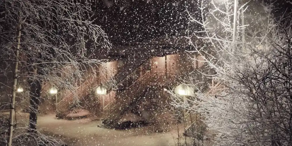
Snowfall in Eastern Regions
The eastern part of the UK saw more than just gray skies.
With the anticyclone influencing weather patterns, cold air from eastern Europe led to notable snowfall.
Eastern areas saw accumulations of about 1-2 cm, with Suffolk even reporting 1 cm over the weekend.
This snow added to the overall dreary and cold atmosphere, making the week feel even longer for residents.

The Role of the Anticyclone
But what exactly has been causing this ‘anticyclonic gloom’? At the heart of it is a large high-pressure system, or anticyclone, that has been sitting over Scandinavia.
This setup has had a significant impact on the UK weather by directing cold winds from the east straight across the country.
The air brought in from Europe picked up moisture from the Baltic and North Seas, resulting in extensive cloud cover across the UK.
Hence, the persistent lack of sunshine and the generally gloomy outlook.
Conclusion
With this persistent high-pressure system, it’s no wonder the UK has had such a gloomy week.
However, changes are on the horizon.
The Atlantic’s influence is set to gradually push the cold air out, leading to a significant shift in the weather.
This transition will be key in bringing much needed relief and brighter conditions.
Regional Weather Variations
The regional weather variations across the UK have been quite contrasting recently.
While eastern regions were blanketed in snow and colder temperatures, western areas experienced milder conditions.
Eastern Snow and Cold
Residents in the eastern parts of the UK faced the brunt of the chill, with temperatures dropping significantly.
Snowfall swept through the area, resulting in accumulations of 1-2cm.
This snowy scene extended from East Anglia to Yorkshire, painting the landscape in a crisp white.
Interestingly, even higher up in Scotland, areas above 100 meters saw a noticeable snow cover, while elevations over 300 meters in Scotland were forecasted to receive up to 20cm of snow.
This severe weather situation was exacerbated by the cold eastern winds driven by an anticyclone over Scandinavia, which brought moist conditions across the Baltic and North Seas, resulting in overcast and gloomy skies.
Milder Western Regions
On the other hand, western regions enjoyed relatively milder weather.
This side of the UK was somewhat shielded from the worst of the cold due to the Atlantic’s influence.
Temperatures here were higher compared to the east, and the west also managed to avoid the widespread snowfalls seen elsewhere.
However, the reprieve wasn’t complete, as intermittent rain showers were expected during the week.
The clash between the Atlantic’s milder air and the cold air from the east created a dynamic front, with weather conditions fluctuating as the battle between these air masses unfolded.
Elevated Snowfall in Scotland
Among the most remarkable weather observations is the potential for heavy snowfall in Scotland.
The highest elevations, particularly those over 300 meters, could see snow accumulations reaching up to 20cm.
This snow is crucial for the region’s environment and can impact local travel and daily life significantly.
The weather here is a direct result of the east’s cold air meeting the highland’s elevation, creating perfect conditions for snowfall.
As we move forward, understanding these regional weather patterns helps us prepare for the changes ahead.
This transition period is just the beginning of more dynamic weather developments anticipated in the upcoming days, with an expected rise in temperatures bringing a whole new set of challenges and opportunities.
The Coming Temperature Surge
The UK is preparing for an intriguing shift in weather patterns.
After a spell of miserable “anticyclonic gloom,” characterized by gray skies and a chill in the air, we’re looking at a dramatic temperature surge starting next week.
A Welcome Warmup
We’ll soon be experiencing a significant climb in temperatures, with forecasts suggesting highs of 13 to 14 degrees Celsius by midweek.
This is a marked change from February’s usual chill, which averages around 6 degrees Celsius in Scotland and 9 degrees in southern England.
After enduring weeks of cold, this rise will feel almost spring-like.
Not a Record-Breaker
While the upcoming warmer weather is certainly something to smile about, it’s important to keep some perspective.
Met Office meteorologist Jonathan Vautrey points out that these expected temperatures, although high, are far from breaking records.
February’s all-time high stands at an impressive 21.2 degrees Celsius, as recorded in Kew Gardens back in 2019. So, while we can expect a pleasant change, it won’t be history-making.
What’s Behind the Surge?
This temperature bump is thanks to a shift in weather patterns.
The Atlantic is playing a crucial role in pushing out the cold air we’ve been experiencing.
As this westerly influence moves across the UK, it’s bringing milder weather our way. The transition won’t be instantaneous—it’ll be a gradual process that unfolds over several days—but by the week’s end, we should all feel the difference.
A Mixed Bag Ahead
Despite the surge, the weather won’t be perfect everywhere.
Western regions may see some rainfall while eastern areas are likely to remain dry.
The milder temperatures will spread across the country, but the exact conditions will vary depending on where you are.
This upcoming weather transition marks an exciting shift, offering a break from the recent gloom.
Everyone can look forward to those milder temperatures and even some sunshine peeking through the clouds.
Looking ahead, this shift in conditions may bring further changes in the weather pattern, adding more interest to the forecast.
Understanding the Weather Transition
As the UK steps away from the recent spell of “anticyclonic gloom,” a fascinating transition in weather patterns is taking place.
This shift promises to push away the cold air entrenched over the country due to a consistent easterly influence and bring in warmer conditions, thanks to the Atlantic’s strong influence.
Atlantic Influence
Over the past weeks, the UK has been under the grip of an anticyclone situated over Scandinavia.
This high-pressure system brought chilly eastward winds across the country, leading to prolonged periods of dull skies, sparse sunshine, and bouts of snowfall especially in eastern regions.
However, meteorologists have observed that the Atlantic is beginning to exert its influence, pushing west to east across the UK.
This transition is integral in replacing the cold air with milder temperatures.
Shift in Atmospheric Patterns
The UK’s weather is set to undergo a noticeable shift as the atmospheric patterns pivot.
Atlantic systems bring warmer, moist air into the mix, gradually easing out the chill.
This process will be slow but steady, with significant changes expected by midweek.
The result? A dramatic temperature surge, bringing the mercury up to an unseasonably warm 13-14°C. This leap from February’s average of 6-9°C will indeed be a welcome change for many .
Regional Variations
Not all regions will experience this transition uniformly.
The western parts of the UK are primed for some rainfall as the Atlantic systems bring moisture along with milder conditions.
On the contrary, eastern regions are likely to remain comparatively drier, albeit significantly warmer than in recent weeks.
Scotland’s higher elevations, which have seen impressive snow accumulation—with some areas potentially seeing up to 20cm—will also witness milder conditions, although the transition might take slightly longer due to their altitude.
As the Atlantic continues to push out the remnants of the cold easterly winds, the UK can look forward to an overall improvement in weather conditions.
This pivotal transition sets the stage for understanding how the dynamic interplay of atmospheric currents dictates our daily weather, opening up discussions on future implications and patterns.


